Saturday, April 7, 2012

It’s Primary Season in the District


It’s primary election week in the District of Columbia. Sure, we don’t have legislative representation at the national level, but at least our congressional district is prettier than yours.

It’s an election year nationwide, and that means that it’s also time for those of us in the nation’s capital to pick the only voting representation we’re going to get. The District votes overwhelmingly for Democrats – it went 93% for Obama in 2008 – so that means that primary elections are a big deal since the winning candidate in this week’s primary election is a shoo-in come November in most city council districts.

There aren't any television ads, but the yard sign budgets must be huge.

I took advantage of a light workload last Thursday to go and vote early at the DC BOEE (Board of Elections and Ethics) headquarters near Judiciary Square. It was nice to vote in person, but I really miss the days of punch card ballots that we used to have at the Tuckahoe Moose Lodge when I’d go watch my parents vote when I was growing up.

I was only able to vote via touchscreen, so I made it a point to spice it up by voting for a write-in candidate. The most notable positions that we vote for in the District (aside from the mayor, who’s not up for reelection until 2014) are our city council members. I live in Ward 2, and there’s just something about incumbent Jack Evans that leaves a bad taste in my mouth, most notably his puzzling support of putting a Redskins training facility on Reservation 13 which 1) is a lovely riverfront site that really deserves some kind of development that people can use, and 2) isn’t even in his district. Since he’s running unopposed, I had to pick a candidate of my own.

I wasn’t the only person to pick a candidate of my own – check out one of the write-in candidates in the Democratic primary at the precinct at my local library:

No, not Francisco Fimbres.

However, the most interesting part of election season in DC are the unusual positions they have us vote for here in the District. Of course we have Eleanor Holmes Norton, our non-voting delegate to the House of Representatives for the last 21 years, but we also choose a “Shadow Senator” and a “Shadow Representative”.

Who else is looking forward to the ANC 2B01 election? Just me? Really?

According to the documents from the BOEE these positions “are local D.C. offices which have the same title as the federal offices that will be created if the District becomes a state.” Officially, they’re supposed to be ready to step in the instant DC is awarded representation, but practically it means they don’t get paid to spend most of their time complaining about our lack of representation to anybody who will listen.
But even though we don’t have a vote in congress, hey: at least my congressional district makes sense. Check it out! Nice, square edges plus the Potomac River.

The District of Columbia: The Densest "State"

You really can’t get a nicer looking congressional district unless you move to Wyoming.

Wyoming is also the only state with fewer people than DC.

It’s certainly better than the gerrymander-tastic Maryland 3. Just look at that thing!


As one resident of MD-3 puts it, “it's so...contiguous”.

Saturday, March 31, 2012

The Beauty and Tragedy of Urban Freeways


Urban freeways are in many ways the pinnacle of the interstate highway system, threading high volumes of traffic into dense cities smoothly, efficiently, and gracefully. However, this regimented order masks the inherent inequity involved in the construction of many urban freeways. In this, the first installment in a 3-part series on road transportation in urban areas, Peter discusses the contradictory nature of the Southeast/Southwest Freeway in Washington, DC.

I was out on a site visit for work today, and as I traveled south from L’Enfant Plaza to Southwest Waterfront (now called “The Wharf” thanks to a branding effort by PN Hoffman) I had to cross the Southeast/Southwest Freeway. As a transit nerd, I have an unnatural fascination with traffic, so whenever I happen to be around highways while traveling on foot I’ll often stop and watch the traffic if I have some spare time. There’s just something that I find thrilling about watching cars rocket out from under your feet and speed off towards the horizon.

In this location, 9 lanes serve 152,000 vehicles per day.
I stood there on the 7th Street bridge over I-395 and watched the rush hour traffic go through its daily grind for a good 8 or 10 minutes. In many ways, there’s an underlying order and elegance to traffic flow. Even though it’s a complicated system with hundreds of thousands of individual drivers making independent, almost selfish decisions, the overall traffic stream works remarkably efficiently because everybody is following more or less the same set of rules.

It’s all very ordered, but at the same time very fragile. Anybody who has ever been stuck in a traffic jam knows just how quickly a small incident can turn a flowing expressway into a parking lot. It doesn’t even take an accident to cause tremendous delays, as you’ll see one of these days when I and some of my grad school buddies get around to writing an article for our new blog, PeopleMovers, explaining the causes behind so-called “phantom traffic jams”.

Between the wonderful weather above, the soothing hum of the freeway below, and the faint scent of blooming flowers being swept uphill from the Potomac on a light spring breeze, it was almost enough to make me forget what I was actually seeing. Almost.

The truth is that the Southeast/Southwest Freeway is 9-lane-wide scar right across the chin of the District of Columbia and a permanent reminder of a terrible and painful time in Washington’s history.

Back in 1956, when the Dwight D. Eisenhower National System of Interstate and Defense Highways was being planned, the Federal Highway Administration drew in a system of 3 circumferential beltways around the Greater Washington area. The outer beltway is known today as I-495, the Capital Beltway, and serves as a crucial yet congested link connecting the suburbs of Washington. In many ways, it is a victim of its own success as by its very nature it has enabled people to have excessively long commutes, thereby adding to the distance traveled by regional commuters and inducing further travel demand – but that’s a story for Part 2 of this series when I explain Wardrop Equilibrium.

DC’s proposed freeway system - click to enlarge. Built roads are shown as black lines and dashed gray lines are proposed roads, including the middle (yellow) and inner loop (red) freeways and the proposed path of Interstate 95 (blue).
Continuing inwards, the middle loop freeway was set to cut through a region that was already well-populated by the time the interstate system was proposed. You have to remember that in the 1950s, over 800,000 people lived within the District compared to the 600,000 that live here today. While large swaths of the middle loop were set to be constructed above existing rail lines or along unpopulated river banks (we’ll ignore the environmental implications of this second choice for simplicity), about 75% of the route was set to replace or be built on top of existing roads: north along Mt. Olivet Road through Trinidad; west across Military Rd through Petworth, Rock Creek Park, and Chevy Chase; south along Nebraska and New Mexico Avenues through Tenleytown and past American University; and finally south through the preserved greenery of Glover-Archbold Park to connect with the Whitehurst Freeway in Georgetown.

As you probably know if you’ve ever looked at a map of DC, there is no middle loop freeway; just the Beltway. Strong protests and legal challenges – led by environmental advocates and residents of the wealthier western neighborhoods of DC – caused the project to be repeatedly delayed and eventually deleted from plans completely in 1977, the year after the opening of Washington’s Metrorail system.

This brings us to the fate of the proposed inner loop freeway. The Southeast/Southwest Freeway – that road that I waxed so romantically about at the beginning of this post – today represents about half of what was to become the innermost beltway, with the remaining sections to be tunneled beneath what is currently K Street NW and Ohio Drive. Just like the middle loop freeway, the inner loop was to cut through well-established neighborhoods along the southern edge. Its K Street section would have even split the central business district in two. Concerns of construction impacts from big business impacts killed the K Street section and the National Park Service nixed the Ohio Drive tunnel, but the Southeast/Southwest Freeway was still constructed because of one important difference: blight.

Living conditions in Southwest DC had been declining for decades, finally reaching a point around 1950 where the area was dominated by shantytowns and poorer neighborhoods that can only be described as slums. The story goes that the Russians used photos of Southwest DC with the Capitol Building in the background as propaganda to illustrate the income inequality in America and by extension the failings of capitalism.

Photo by Dmitri Kessel for Life Magazine.
So early in the 1950s planners from DC and the federal government decided to start a massive urban renewal campaign, effectively wiping Southwest from the map through eminent domain and starting over from scratch. The residents of Southwest, who were generally poor and lacking in education, simply lacked the social standing and clout to have their complaints taken seriously and could do nothing but watch when their vibrant – albeit economically depressed – neighborhood was razed.

Southwest in 1955 - Vic Casamento for the Washington Post.
(You can see the freeway construction just right of center
between the railroad tracks and the vast expanse of empty lots).
Today, Southwest DC is cut in half by the Southeast/Southwest Freeway. North of I-395, the Southwest Federal Center is a depressing mass of brutalist concrete architecture that completely empties out after business hours, becoming a void lacking in economic activity or foot traffic of any type. South of the freeway is block after block of public housing that’s only recently started to see new developments like The Wharf on Maine Avenue or Waterfront Station on 4th Street SW. The region is still considered to be a sketchy enough place that they sent me to do the site visit in place of one of the company’s female staff engineers just in case.

This part of Southwest definitely has some foot traffic and a few commercial activities, but what exists today is a far cry from what there used to be in the 40s and 50s with the old Maine Avenue Fish Market and the nearby commercial activities. Slum or not, the neighborhood had an identity back then; a distinct feel and attitude that set it apart from the rest of the District. Instead of trying to help the population improve themselves, a bunch of planners who thought they knew better cleared the whole thing out and created a contrived neighborhood in its place that might have all the makings of a community but is somehow lacking in soul.

To me, the Southeast/Southwest Freeway is a reminder of why planners and engineers must make sure that all parties, no matter how disadvantaged, have a say in urban development. Far too much of the original interstate system was built like this in urban areas; bisecting the poorest neighborhoods in a town without considering the impact to those communities in the coming decades. A freeway isn’t something that you can “undo”, and so we all must live with the consequences of our own poor decisions since it was we as a society who let this happen time and time again.

Still, whenever I see the Southeast/Southwest Freeway, I can’t help but think of the tragedy of the situation. Here, we took a neighborhood that tens of thousands of people called home and turned it into a place full of people who would love nothing more than to be someplace else.

Monday, March 12, 2012

DC’s Architecture Hates Airplanes

Just about everybody who knows me realizes pretty quickly that I’m a bit crazy. However, every group of people seems to find this out about me in different ways. My college friends were on to me that one evening I ran down to the bottom of the stairwell and started making dust angels. I’m guessing that my coworkers at my first internship were convinced in the third week when I sat down in the recycling bin to compress the papers. But my coworkers at my new job figured it out even more quickly than that, and it’s for reasons that those of us who aren’t from DC might think is a little odd. My boss almost immediately declared me crazy because I was planning to continue owning a car after I finished moving all my stuff.

I’m now a full 9 months into the job, and I’m still pleased with my decision to keep the car. Even after paying for parking, I find it totally worth it to be able to hop in my car and drive down to Richmond for the weekend or to jet off to visit a friend in suburban Virginia after work. I’m one of the staunchest supporters of public transit and bike usage that I know, but there are just some places – like large swaths of Richmond – that aren’t served well enough by transit and are simply too dangerous to bike to get by without one.

Looks like fun!

But a lot of people at work still don’t quite get it, and it’s after days like today that I come a bit closer to seeing things their way. Today, my car had its 120,000-mile service, and the list of fluids and filters that need to replaced in conjunction with a litany of components to inspect and clean or rotate or flush makes for a pretty substantial bill. However, I’ve got to say that the whole thing was a pretty pleasant experience, mainly because of the location of my dealer.

I first moved to DC needing a whole mess of services. I was way overdue on an oil change, and the car was leaking oil from a variety of places to boot. That was back when I didn’t really know anybody well enough to help me drop my car off, so I was very pleased to find that the nearest Subaru dealership happened to be within a block of the White Flint station on the Metro Red Line. That’d been my original plan for dropping the car off on Sunday, but the weather was JUST SO DARN NICE OUT that I had to try something different.

And that’s when I decided to ride my bike back from the dealer.

18 miles of awesome!
DC’s got a lot of great bike trails and paths, and one of the most notable ones is Beach Drive through Rock Creek Park. During the week, Beach Drive is a popular road for commuters because although it only has a 25 mph speed limit, it only has about a half-dozen traffic lights between Bethesda and downtown. However, on weekends the National Park Service shuts down the road to through vehicular traffic, and it becomes a haven for joggers and cyclists, and I just had to check it out.

"Welcome to Rock Creek Park: Reserved for non motor vehicles' use, 7am Saturday to 7pm Sunday"
Beach Drive is winding and convoluted, but it’s mostly flat and ridiculously scenic. In addition to many scenes of gentle cascades through mild gorges, Beach Drive also treats you to views of a number of DC landmarks, including the LDS Washington D.C. Temple.


Built in 1974, the Washington Temple rises 288’ from a hill just north of the Capitol Beltway. If you’ve ever taken I-495 around the north side of DC, chances are you’ve seen the building – it’s quite imposing.

From user IFCAR on Wikimedia Commons
But as I rode past the Washington Temple on Sunday, I was struck by one thought, and one thought alone: I bet that thing would look really aggressive from the sky.

From DOD Media Service
This isn’t an isolated case – most of the tallest buildings in DC would look pretty menacing to somebody in a parachute. In fact, 6 of the 7 tallest buildings are pointy, and #4 (Washington National Cathedral) and #7 (the gnarlily gothic Healy Hall at Georgetown) are located along the approach path to National Airport.

You can actually see DCA in this photo, about 1/4 from the left.
From user Patrickneil on Wikimedia Commons.
All in all, I imagine they make it pretty intimidating to be a pilot flying around the District. But none of those buildings hold a candle to the US Air Force Memorial, looming 270’ over I-395 near the Pentagon. It’s meant to evoke the "contrails of the Air Force Thunderbirds as they peel back in a precision 'bomb burst' maneuver”, but I just know in the back of my mind that it’s waiting to spear a wayward commercial airliner.

From user Blacknell on Flickr
And that’s why DC’s architecture secretly hates airplanes.

Tuesday, January 31, 2012

Capitalsaurus Day


Following last month’s post about traffic circles, I now present Part II in the series about DC curiosities.

I’d just like to start out by quoting Dave Barry and reiterate that I Am Not Making This Up.

My second day on the job, back in June, was very eventful. I turned in my security deposit and got my keys, I used Visio to make a map for the first of countless times in my job, AND I got to go on a site visit.

I was tasked with evaluating on-street parking for a new condo development on New Jersey Avenue near the Southeast Freeway where the municipal garbage transfer station is now.

A garbage processing center... with a view!

I took Metro down there and then walked all over, covering a 3-block radius of the site. At one point I walked under the Southeast Freeway and found Garfield Park. It’s a nice place, but as I walked up F Street I saw something interesting at the corner of 1st and F, SE. At this corner, F Street is also labeled “Capitalsaurus Court”.

NOT MAKING THIS UP.
Now, a lot of states have official fossils – only 8 do not. State dinosaurs are more rare, with only 6 states and the District of Columbia naming an official extinct oversized lizard.

Normally I think of dinosaurs being more of a western thing. I don’t actually have any hard research to back that up, but if Jurassic Park taught me anything, it’s that all the major paleontology work goes on out west. Well, that, and Dinosaur National Monument is in Colorado. Thanks, Discovery Channel!

So you can imagine that there’s a curious story behind why the District of Columbia’s official dinosaur is actually named after DC.

In January of 1898, DC’s expansion had come to the 100 block of F Street SE. Construction workers putting in a sewer line were working through the rocky, marshy soil when they came across a very large bone fragment. Somebody determined that they’d actually found a dinosaur vertebrae and so on January 28, 1898 a man named J. K. Murphy brought the vertebrae to the Smithsonian Institution where it was entered into the museum’s collection.

In 1911, (and here I’m going based on info from Smithsonian magazine) one paleontologist classified it as Creosaurus potens. In 1921 another paleontologist overruled him and decided it was actually  Dryptosaurus potens. 70 years later, after a LOT of looking through books, the paleontology community concluded that it was actually a completely unique dinosaur and named it “Capitalsaurus”. Now, it’s never been assigned a complete description – remember, we’re just going based on a single vertebrae here – so it’s an unofficial name and technically the quotes are part of the official terminology.

But that didn’t stop somebody from coming up with an artistic representation… that appears to have been done in colored pencil.
Finally, in 1998 the DC council passed the Official Dinosaur Designation Act of 1998, declaring January 28 to be Capitalsaurus Day. It’s pretty much just celebrated by elementary school students, but since I’m new here I figure I get a pass to celebrate it whenever I please.

And that’s the story of my second day at work.

Next time, we learn about my most cherished meal tradition: no, not Steak of the Union, although you’re close. It’s Discount Supermarket Steak Night!

Saturday, December 31, 2011

Dave Thomas Circle

This is Part I in a series on curiosities about my (relatively) new home, the District of Columbia. Today, we discuss Traffic Circles.

Pierre L’Enfant was a jerk.

Sure, the street grid he set out for DC has some truly fantastic public spaces and grand boulevards, but all the monumental axes and diagonal streets really slice up the available space, leaving lots of unusual triangles and pocket parks. Pretty much all of those spaces within the central part of DC are governed by the National Park Service, who controls 637 distinct parcels for recreation and presumably the eventual installation of monuments to increasingly benign national figures and historical events. In total, the NPS possesses some 6,700 acres out of the 39,300 acres (land only) of the District. That’s about 17% of the District, and when you add in other federal land it brings the total up to about 23%... which is still lower than 12 other states. (Nevada is 84% federal land!)

Anyway, several of these spaces are circular. A few are technically roundabouts, but the vast majority of them have some form of signalization and are therefore classified as traffic circles. All in all, there are 34 circles in the District of Columbia, of which 31 are named after noteworthy people. However, recent developments at one intersection have raised that total up to 35, as we’ll see in a moment. But first, some Traffic Circle Trivia!

The Smallest Circle

Anna J. Cooper Circle is the smallest named circle. There are several smaller ones, but they’re little more than mini-roundabouts with some grass in the middle.

Cooper Circle has benches and trees!
The Largest Circle

The largest circle is Dupont Circle, for which the neighborhood I live in is named. The landscaped part in the center is a whopping 360’ across and is home to a fountain, a half dozen chessboards, 1200 linear feet of benches, and a small population of homeless people who seem to enjoy shouting at passersby on Friday and Saturday nights and at each other all of the other nights of the week.

Massachusetts Avenue is busy enough that it gets express lanes (blue) around the inside of the circle, but Connecticut Avenue traffic is even heavier, so it gets a tunnel under the circle (green).
If you want to get technical about it, Grant, Logan, and Sherman Circles are also 360’ across; however, Dupont Circle lies at the intersection of 10 different spokes, so I’m inclined to give it the “largest” crown. Between the 10 roads, 104,000 vehicles traverse Dupont Circle every weekday… and that’s really quite a lot. Even the busiest stretch of highway in all of Richmond (I-95/I-64 at Belvedere) only carries 126,000 vehicles/day.

The Least Circular Circle

Many traffic circles have been modified over the years to better handle the ever-increasing volumes of commuter traffic present along DC’s roadways. Dupont had a tunnel and express lanes installed, but at least it’s still a circle. Not all “circles” have been so lucky – many have had the primary road punched through the center, and in some cases all that remains of the circle are some glorified frontage roads, much like the ones found at Wesley Circle near American University.

The Maryland-Isn’t-A-Team-Player Circle

DC has a thing for perimeter roadways. Nearly all of its border with Maryland is marked by roads with uncreative names like “Southern Avenue,” and like many other major intersections in the District some intersections along these roads have circles as well. Most of them straddle the border, but Pinehurst Circle in Chevy Chase doesn’t quite line up properly.

The Newest “Circle”

New York Avenue carries US 50 from downtown out towards Annapolis. There used to be a traffic circle at its intersection with Florida Avenue, but eventually traffic volumes got so high along New York Ave (currently about 60,000 vehicles per day) that the District decided to take out the circle and put in a traffic light that favored commuter traffic. However, the redevelopment of several commercial corridors along Florida Avenue – U Street to the north and H Street to the south – has meant that a the side street volumes are swiftly approaching the limit of what the signal can handle, and there simply isn’t room for more traffic lanes.

The intersection is kind of a big deal.
When this happens, pretty much the only way to improve traffic flow is to find some way to reduce the amount of lost time in the signal’s cycle, and that usually means removing phases. By reducing the number of times the signal has to switch in a given cycle, the amount of time lost to yellow and all-red signals is reduced, giving a corresponding reduction in the delay experienced by vehicles since more of the cycle is spent with the light showing green.

Another issue at this intersection is a common one in DC – everything’s simply too close together. L’Enfant’s diagonal streets certainly make trips shorter, but they also confound the street grid. At the intersection of New York and Florida, there were 5 intersections within a 50-yard radius, which made coordination of the signals somewhat tricky.

So after a long period of study, what the District of Columbia Department of Transportation (DDOT to you and me… even their logo is just “d.”) decided to do is to create a virtual traffic circle using the existing street network. First, they kept traffic along New York Avenue as it was, except they prohibited left turns from the main roadway. Next, they converted a block each of Florida Avenue, 1st Street, and O Street to one-way operations in order to create a “traffic triangle” with a Wendy's in the middle.

Image from Flickr user tbridge
The Point

The punchline of this situation is that while most traffic circles in DC are named after locations, politicians, and generals, this one has been given a quite relevant and, in my opinion, humorous name. Because of the presence of a Wendy's on the island in the middle, people have started calling this one "Dave Thomas Circle" after the founder of Wendy's. I guess he counts as a famous American.

Now, the operations of the circle are pretty cool too. If you want to travel southbound on Florida avenue, you have to turn right on 1st then left on O to travel around the legs of the triangle. If you’re heading east on New York and you want to turn left onto Florida, you actually have to turn right onto O before you can turn left onto Florida and shoot across the hypotenuse.

Click for a bigger version. Please, I spent a lot of time on this.
It may seem unnecessarily complicated, but from an operations standpoint it lets the “circle” operate in only 3 phases:

  1. Eastbound + Westbound New York
  2. Northbound Florida + 1st
  3. Southbound 1st + Eastbound O

instead of the 5 phases that all of the intersections were using before:

  1. Eastbound New York + lefts
  2. Eastbound + Westbound New York
  3. Westbound New York + lefts
  4. Southbound Florida + 1st
  5. Northbound Florida + 1st

The cycle length is still 100 seconds, but the extra 8 seconds of lost time gained every cycle (3 yellow + 1 all red for both trimmed phases) adds up to a considerable bonus over the course of a day.
The funny thing is that this blog post – from the research to the pictures to the writing – is pretty much just a very disorganized version of the kinds of things I do at work every day. And that’s what makes me look forward to coming in to work in the morning. DC’s doing some pretty fascinating things with traffic operations… and that’s before I even consider some of the neat bicycle facilities or transit infrastructure that they’re working on. It’s simply a great time to be a transportation engineer in the nation’s capital.

Next time, in Part II of my series on DC Curiosities, we’ll learn about the District of Columbia’s official dinosaur just in time for CAPITALSAURUS DAY!


And yes, with the possible exception of me blowing off another deadline and missing Capitalsaurus Day, none of that previous sentence was made up.

Sunday, November 27, 2011

UPDATE: My Spacious Studio Apartment Now Has 8 Rooms!

Those of you who were paying attention to the teaser at the end of the last posting may be wondering what ever happened to my planned update about election season in DC. Well, one of the things about having state and city government be one in the same is that they don’t need to have elections as frequently. So… it turns out that the next election cycle isn’t until 2012. Stick around for that one, I guess.

This blog prides itself in its accuracy. Well, that’s not entirely true – since large swaths of what I write about are made up, I suppose it’d be more accurate to say that this blog prides itself in its factualcy, or factual accuracy. And so in the spirit of factualcy, I must provide an addendum to my previous posting because in the last month, my spacious seven-room studio apartment has gained an eighth room.

8. Sprocket’s Room

Sprocket is a cat.

Caught wet-nosed again!

Sprocket came to live with my family in 2001, back when he was just a kitten.

Here he is with his sister Tsali. Look at those ears!

Because of recent events, Sprocket has come to live with me! Unfortunately, after 10 years of living in the same surroundings, the fact that he was essentially kidnapped, stuffed in a box, shaken around in a car for 2 hours, then dumped out into a small apartment while trash collection was going on in the alley behind my place didn’t sit well with him.

He spent the first two days or so hiding under my sofa. Unfortunately,
he's bigger than he thinks and so his butt still stuck out comically.

Eventually he adjusted to his new surroundings and started doing normal cat things…

...like eating...

...and licking his butt.

For some time now, Sprocket’s favorite place to stay has been an old Amazon box that I got when I ordered some CDs – Daft Punk’s Discovery and Rick Astley’s Whenever You Need Somebody, to be precise – and so naturally I brought it along as a part of the move.

The ideal cat box: short enough to see over and still slightly too small for the cat.

Sprocket has pretty much free reign over my apartment, but he still spends the majority of his time curled up in his “room.”

This, of course, exposes his fuzzy underbelly to much rubbing.

But it’s a pretty good place to sit, nestled in between my dining room and my office.

http://vimeo.com/32397612

Occasionally he will come out, but most of these times he still prefers lying down to actually being a productive member of society or contributing to rent or any of those things that would actually be helpful.

Here he is on his side, blocking my keyboard.
And here he is blocking pretty much all of my desk space.

He also likes to be up high, and luckily for him my bed fits that description. Unfortunately for me, he also likes to sit on comfy pillows while he’s up there, so I’ve had to bring my old king-sized pillow out of retirement from back in the day when he and his sister would both crowd me off of my normal pillow back during high school. Even with the garguntan pillow taking up the entire width of my mattress, he still practically crowds me out as you can see below.

This is how he wakes me up at 5am some days; reminding me that he
hasn't eaten in upwards of 4 hours.
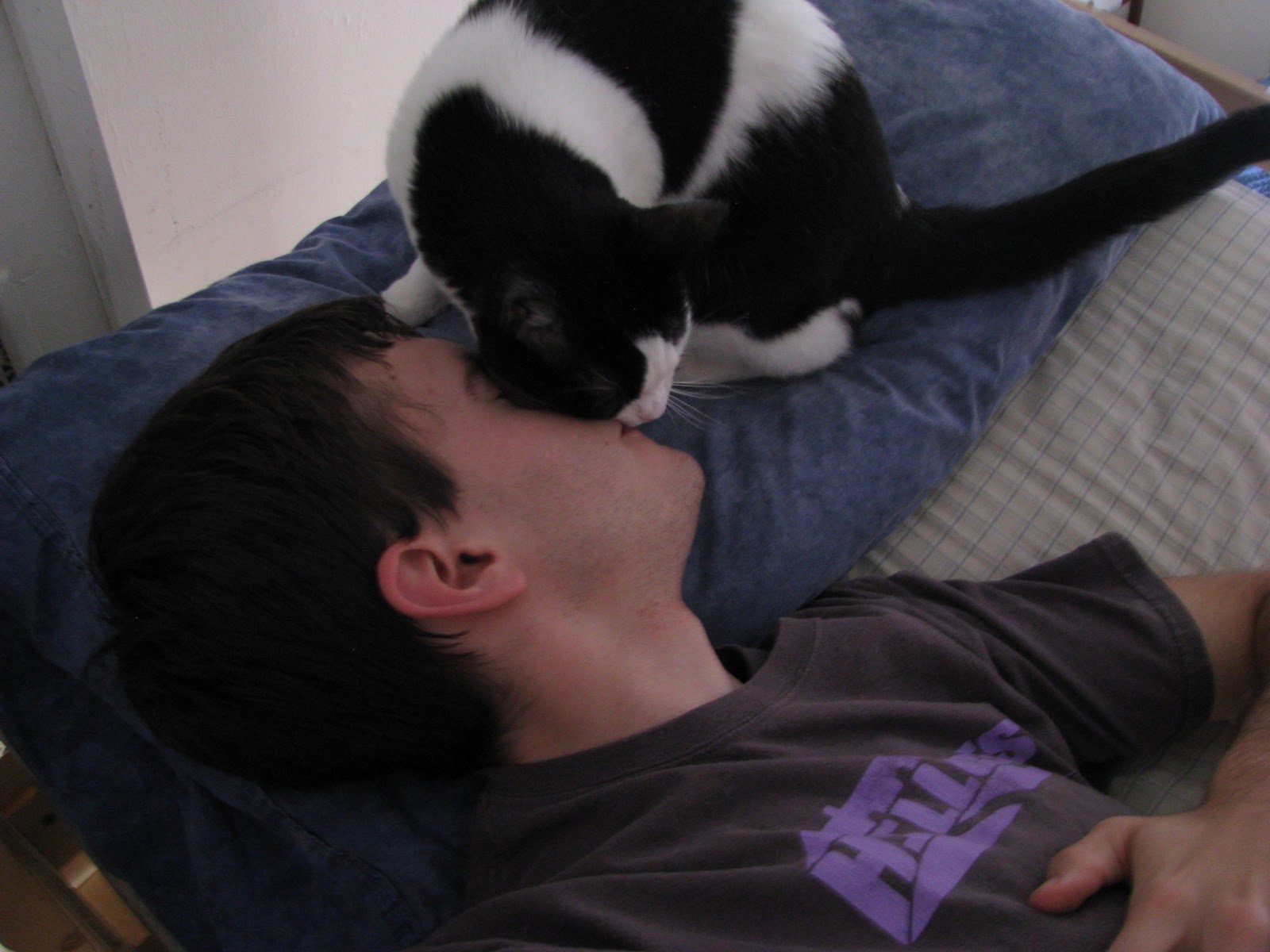
Eventually he gives up and helps keep my face warm.
...although sometimes he picks an orientation that I don't really like.
Next time, we go on a tour of my local neighborhood and see all the lovely amenities like Dupont Circle, the National Museum of Jewish-American Military History, and Scientologists.

Friday, October 14, 2011

A Tour of My Spacious Seven-Room Studio Apartment


So I may be living in a 340 square foot box, but it’s actually pretty spacious for a single guy with low standards. In fact, if you’re willing to put a positive spin on it, I actually lucked out and found myself a seven-room studio apartment!

Now when I say that my apartment has six rooms, I’m not really even cheating and counting the bathroom or the kitchen. And although my bathroom is quite cramped, my kitchen is sized to be an eat-in kitchen, which makes it pretty spacious. I seriously considered putting my bed in the kitchen before I finally decided to buy a loft bed frame. But on a more practical note, what having a eat-in kitchen that you don’t eat in means is that you’re basically just short on counter space all the time. At least I’ve got a nice fridge and a generous freezer. And if you’ve ever lived with me, you know I can fill up a freezer.

This camera is sitting across the hallway from the bathroom, and this
is the widest shot I could get. It’s that cramped.

55 sq. ft. of floor space, 5.5 sq. ft. of counter space

So that brings us to the main portion of the apartment. It’s a studio, but it’s very well equipped for being built 103 years ago. Let’s begin the tour!

The Entry Hallway, or as I like to call it, The Chart Room
It seems like a big hallway would just be eating up my already scarce square footage, but it’s actually a pretty nice thing to have. It’s a pretty nice place to put up all of my wall art (which for me is mostly maps), but the thing I appreciate most about my hallway is that it gives me some good separation from the common hallway. The doors don’t seal particularly well – I can see my ceiling from the hallway through the gap above the door – and my hallway keeps my bed about 10-15’ from anything that’s happening out there. This is compared to my neighbor to the north (we’ll refer to him as “Canada”), who because of the layout of his apartment has to lay his head right next to his front door.

Fun Fact: I am required by my lease to keep at least
80% of my hardwood floors covered by carpets. 

The Dressing Nook
At the end of my hallway is a weird nook where the hallway suddenly doubles in width. I can only imagine what it looks like in Mexico’s apartment (in keeping with the neighbor analogy). Anyway, it’s as good of a place as any to keep my dresser. Opposite the nook is my surprisingly large closet, which is even more impressive to me considering just how little closet space I got by with during college since all my closets wound up being full of pipes. There’s even enough space in my closet to store my spare dining room table chairs, and they double as a nice place to put my shoes on in the morning.

Coat Rack, Mirror, Ticket Stubs, Hallway, Map, BELLY BUTTON!
The Dining Room
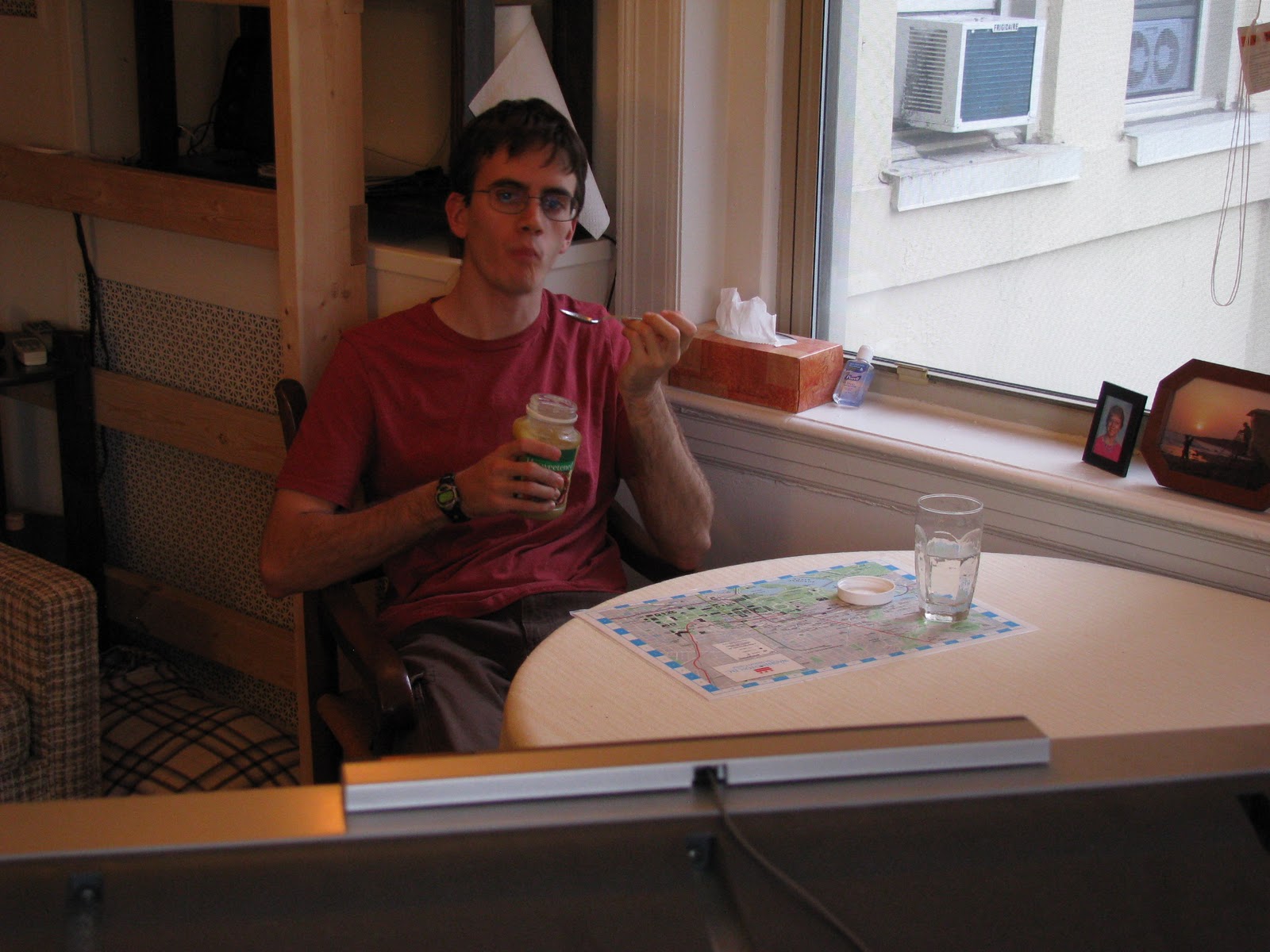
One of the many pieces of furniture that I picked up from family members was my grandmother’s very nice solid wood dining room table. It didn’t sell on Craigslist, so she decided to give it to me as payment for listing all of her furniture items on Craigslist. That’s the Circle of Used Furniture, right there. Anyway, my dining room’s got a table and a TV, and that’s really all I need. Plus, the table is pretty big and it even has a leaf that I can add, so if any five of you want to come visit I do have the capability to host you all simultaneously. It just might be hard for us all to watch TV.

Although this photo is staged, I do routinely eat applesauce
straight from the jar. What are you going to do about it?
The Office
I also have a very nice desk in my apartment. Solid wood and everything! And… a tablecloth. Okay, you figured me out – it’s just the dining room table. But the thing’s big enough that it all works out. All of the computer stuff clears off of the desk and can be stored on the adjacent table along with the external monitor and my printer in seconds flat for hosting purposes. (hint, hint) I also get to stare up at my Wall O’ Memorabilia when I get tired of watching prairie dogs ride around on a Roomba.

Tory was nice enough to let me win at Fantasy Football this week, by the way.
The Living Room
Home to my fold-out queen-size sleeper sofa, yet another failed Craigslist sale item. Although I can testify that the top is good for sleeping too, if a bit short. The poster is something my college dorm's RA's earned in a trivia contest (so naturally I'm the one who has it now), and the rug is where I do Wii Fit to keep from getting Way Fat.

Seriously, my morning routine has gotten to be this: wake up, bathroom,
check email, nap for 15-20 minutes on the couch, Wii Fit, shower, work.
The Den
In addition to the couch, I have 9 chairs in my apartment including this recliner, a hand-me-down from Richmond Brad. In conjunction with my surround sound speakers, having a comfy chair really makes my old dorm TV seem like a lot more of a cinematic experience. Well, that and sitting 5’ from the screen helps to make the thing seem a lot bigger. Add an air conditioner, a FDR blanket, and a space heater and you’re good through all seasons.

You can really see the disappointment on Tom Brady’s face after
throwing a red-zone INT at home for the first time ever from 5’ away.
The Bedroom
My bedroom back in Richmond isn’t much smaller than the main room here at my apartment. I’ve really only got 12’3” by 12’9” of contiguous space, and honestly when I first tried to come up with a good furniture layout I was afraid that it’d really feel like I was living in a bedroom. But I’ve put the bedroom last on this list because it really is the last place I feel like I am when I get home from work. Office, living room, dining room, all of those seem obvious – but by putting my bed 7’ up in the air I really do forget about it until it comes to be time to go to bed. And while at its most basic your home really is just where you lay your head at night, you really don’t need much in the way of furnishings to make a bedroom comfortable. It’s not like you’re going to be conscious long enough to appreciate it that much. A clock, a fan, a pillow, and that’s really about it.

10’ ceilings are AWESOME. So is having 3 nice, large
windows... Except when you're trying to sleep in.
Well, that about does it for our tour of my spacious, well-equipped studio apartment. I certainly find it functional, especially for my purposes as (1) a guy (2) living alone (3) who likes to watch TV and classic movies. Heck, with those qualifications I could live in 60 square feet and get by pretty well. Just throw in free meals and free cable and... well, I guess that would make my optimal living space be "prison."

Tune in next time when I'll give you a preview of election season in DC. You'll be surprised to hear some of the weird things they have us vote on, and also to find out why people who go to Purdue University have more of a say over the DC budget than I do.