Wednesday, August 1, 2012

Still More Evidence that My Entire Childhood was an Elaborate Implanted Memory


"...a little of the Ludwig Van."
Science fiction and fantasy works have long served as a way of exploring and discussing the human psyche through an accessible and understandable framework. One needs only consider the visceral, emotional responses to Orson Welles’ 1938 War of the Worlds broadcast to see just how easily these stories can really dig deep down into our minds and nest there. Today, through popular culture and especially film, these stories have a broader exposure than ever before. We’re finally starting to see the impacts of some of these discussions on both psychological research and psychiatric diagnoses.

Disclaimer: I have no psychiatric training of any sort (as evidenced by the fact that I had to look up how to spell “psychiatric”), so please take every conclusion I make in this essay as pure BS.

The Matrix has revitalized the study of consciousness and brought both support and scrutiny to the “Brain in a Vat” thought experiment. Christopher Nolan’s Memento gives us an interesting (and apparently fairly accurate) look into the world of an amnesiac. And who could forget Russel Crowe’s memorable portrayal of Nobel Prize-winner John Nash’s slow descent into schizophrenia in the much-lauded A Beautiful Mind?

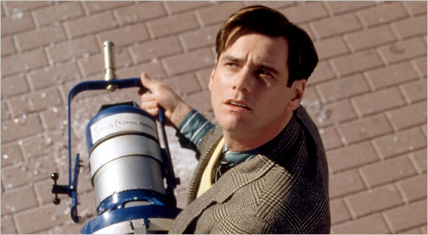
But sometimes the fanciful concepts introduced in fiction cross over into our world and become legitimate issues for people. The accessible nature of film and the vivid realism of contemporary filmmaking can sometimes serve to bring out or accentuate existing psychological issues. One of the first places I was really able to understand this was when I read about The Truman Show Delusion in high school. Truman was and still is one of my favorite films, and in the movie Jim Carrey plays Truman Burbank, the star of the world’s most popular TV show. However, what makes the show so popular is that it’s just a realistic portrayal of normal life, to the point that Truman doesn’t know that he’s spent his entire life in a fake city populated by actors with over 5,000 cameras broadcasting his spontaneous actions around the globe.

"Oh, and in case I don't see you: good afternoon, good evening, and good night!"

It’s a really fascinating concept, and sometimes when I’m bored I’ll even look around the room where I am and try to figure out what the best camera angles would be and where they’d stuff the craft services table if my life were a TV show. However, to people suffering from The Truman Show Delusion, things go quite a bit further into borderline schizophrenia. One documented case tells of a patient who “traveled to New York City after 9/11 to make sure that the 2001 terrorist attacks were not a plot twist”. A common theme in the reported cases is that the Trumans generally perceive “that the ordinary world has changed in some significant but inexplicable way”, including how others interact with them, and they conclude from these perceptions that they are living in a “fabricated world”.

It’s the theme of fabricated reality that I want to talk about today, and it ties in to one of the most iconic science fiction films of all time: Ridley Scott’s Blade Runner. In the film, Harrison Ford’s character is tasked with hunting down rogue androids. In both the book and the film, the “replicants” are given artificial memories to make them more relatable to humanity, which in some ways parallels the artificial reality present in The Matrix. Like The Matrix, Blade Runner’s implanted memories are so convincing that the cast includes at least one (WARNING THIS LINK IS A SPOILER) replicant who thinks they’re human.

"I've seen things you people wouldn't believe..."
Implanted memories are an alternative explanation to explain “inexplicable” changes in the world like those described by Trumans, and are seized upon by ufologists and conspiracy theorists to explain something that’s just not quite right about their recollection of the past. Although I’m not a member of any of those fringe groups, I’m all out of plausible theories to explain one of the more improbable coincidences of my entire childhood. As Sherlock Holmes said, “when you have eliminated the impossible, whatever remains, however improbable, must be the truth.”

What I Remember

In elementary school in my county, there was always a unit where we were supposed to write a story. In upper grades, we were expected to write the whole thing ourselves, but in the lower grades we’d describe the story to a volunteer parent, they’d type it up for us, and we’d just do the illustrations.

My kindergarten story was about a group of flying snowmen traveling the world. It was fantastic, and there were only about 25 words. Take that, Tolstoy.

My second grade story was about a pair of skis who moved on their own when somebody left the door open. Since we always wrote the things during winter when there were limited opportunities for recess, you can tell how enamored I was with a ski trip or something.

My third grade story involved a kid who hiked up Mt Everest. It was the first one I wrote myself, and you can tell that “random adventure” is a theme in all my early “books”.

But the one that I’m here to tell you about today is from first grade. If you believe my memory, in February of 1993 I wrote a book called Scamper the Penguin and His Adventures. I still have the thing, and I’ll reproduce it for you in its entirety here:


All in all, it seems like another benign adventure story.

The Troubling Coincidence

During a random Wikipedia search, I recently became aware of a joint Japanese-Soviet animated film released in 1986 called The Adventures of Scamper the Penguin (trailer). Now, sure, they did release an English dub of the film in 1989, and it’s possible that I saw it in preschool and described it to the parent volunteer who didn’t recognize it as somebody else’s story and was just happy to be done with all these snotty-nosed kids in the middle of cold season… but of course I would never plagiarize something so obviously that’s not a logical explanation.

They even got my red penguin from the last page!
Clearly, the only possible explanations are: 1) the producers stole my idea and then went back (to 1986 of all places) and wrote Priklyucheniya Pingvinenka Lolo or 2) my entire childhood was a lie. For the sake of sensationalism, I choose #2.

In the next post, Peter promises he won’t engage in wild, fictional speculation and will instead cross-post something he’s been working on for PeopleMovers. Also, the article will be shorter.

Tuesday, June 19, 2012

Tory is Always Right

I often think about the friends I made back in college. We had some pretty wild and crazy times, and I’m fortunate to still be able to keep up with some of them, although not as much as I’d like. There are a lot of triggers that make me think about The Good Times, not the least of which is my Wall O’ Photos opposite my desk at home. However, there’s probably nobody I think about during the time when I’m at work than my friend Tory, and that’s not just because his name’s on the toilets.

I bless the rains down in AFFFFFricAAAAAAAAA…

But seriously, the real reason I’m reminded of Tory is that a large number of pictures in my computer’s desktop slideshow both at home and at work are from places that I wound up visiting almost entirely due to his recommendations.

Tory’s always been a very savvy traveler. Although we do kid him about the fact that he only owns one shirt, he’s managed to put together some truly spectacular expeditions to very good at planning out fantastic expeditions to places throughout Europe.

In all fairness, who doesn’t like Cheerwine?
So when I found out that I would be attending a research conference in Finland in the summer of 2010, I saw it as an opportunity to have a Scandinavian adventure - and I knew that I needed to sit down with Tory and get some advice. Tory told me about all the places he’d been to, from his time wandering throughout Oslo to ski trips out in Stryn. However, the one place that he seemed to highlight was a tiny town on the Songenfjord in Norway called Flåm.

And so based entirely on Tory’s recommendation, on the second day of my trip I found myself on the overnight train traveling westward from Oslo Central Station towards Flåm, some 200+ miles in the wrong direction from Finland. Flåm, pronounced like the weird Nickelodeon-marketed substance floam from my childhood (which they apparently still make?), is a town of about 450 people which is really quite difficult to get to. To access the town by car from Oslo, you either have to make the arduous journey through the mountains of central Norway or you have to use the Laerdal Tunnel, which at 15.2 miles is the longest vehicular tunnel in the world.

The tunnel is 4 miles longer than the next longest road tunnel, so they decided to put in several artificial caves inside the tunnel so you can rest your legs and your brain. (photo from Wikimedia Commons)
However, the trip is totally worth it. The reason Flåm is so difficult to get to is the reason it is such a fantastic place to visit, since the village is nestled in a valley at the head of the Aurlandsfjord, deep in Norway’s spectacular fjord country. It really doesn’t matter whether you’re looking up at the towering cliffs from a tour boat, gazing across the valley from an impressive vista on a mountainside trail, or marveling at the innumerable waterfalls as you make the steep descent down the spur rail line into town on a specially designed train – there simply isn’t a bad view to be found.

The Myrdal train station is simply dwarfed by this absolutely fantastic waterfall... and you're just sitting there reading a book like you're on the Washington Metro? What the heck is wrong with you, lady?

And so once again, I took Tory’s example before me and went photo-mad, using up multiple sets of batteries in a single 24-hour period in my vain attempt to make my brief stay in Flåm last longer through film. Just check out how I blabber on about the trip in my extraordinarily lengthy blog entry (scroll down to June 4  for some pictures of the place and the story of how I spent 5 hours asleep on the floor of a train station in the middle of nowhere to make a transfer to the Flåm railway).

I really would love to show you all a bunch of photos about the things I saw in Flåm and the hike I took (again, at Tory’s suggestion) from Aurland at sea level up to Prest Peak at 4,460’… but as I just said, I’ve already written about it once. The fact is that the place has had a lasting impact on me – hardly a week goes by that I don’t have some kind of fond memory about meeting the ill-prepared Japanese tourists getting drenched at the base of the Kjelfossen waterfall or following the hiking trail through a field past a picturesque yet decrepit barn or of how the oppresively overcast conditions broke through to sun just as I crested the ridge and got my first view of the fjord from above. It really was that spectacular of a place.

Granted, part of the reason why I think about those experiences so much is because these and other pictures from Flåm show up with great frequency on the desktop background slideshows of my various computers. Since I deliberately pick every photo that shows up in my desktop slideshows, that got me thinking: I can use the distribution of pictures in my desktop slideshow to quantify just how spectacular the Aurlandsfjord really is.

Sometimes there are simply no words on it.
(photo: Wikimedia Commons; link: very NSFW)

The pictures from my trip to Flåm make up a whopping 14.4% of the photos in my desktop slideshow, which is all the more impressive when you realize that I was only in town for a 22-hour period in June 2010 – approximately 0.010% of my life. If we assume that the photos I’ve selected to be in the slideshow (and they go back many, many years) give a good sampling of the things I choose to remember from my life, then I took photos in Flåm at a rate that was 1,593 times as high as the rate at which I normally take noteworthy photos.

The simple conclusion that I draw from this data is that Flåm is about 1,600 times more picturesque than the average place on Earth – and that’s why you should always listen to Tory whenever he tells you to do anything.

Saturday, April 7, 2012

It’s Primary Season in the District


It’s primary election week in the District of Columbia. Sure, we don’t have legislative representation at the national level, but at least our congressional district is prettier than yours.

It’s an election year nationwide, and that means that it’s also time for those of us in the nation’s capital to pick the only voting representation we’re going to get. The District votes overwhelmingly for Democrats – it went 93% for Obama in 2008 – so that means that primary elections are a big deal since the winning candidate in this week’s primary election is a shoo-in come November in most city council districts.

There aren't any television ads, but the yard sign budgets must be huge.

I took advantage of a light workload last Thursday to go and vote early at the DC BOEE (Board of Elections and Ethics) headquarters near Judiciary Square. It was nice to vote in person, but I really miss the days of punch card ballots that we used to have at the Tuckahoe Moose Lodge when I’d go watch my parents vote when I was growing up.

I was only able to vote via touchscreen, so I made it a point to spice it up by voting for a write-in candidate. The most notable positions that we vote for in the District (aside from the mayor, who’s not up for reelection until 2014) are our city council members. I live in Ward 2, and there’s just something about incumbent Jack Evans that leaves a bad taste in my mouth, most notably his puzzling support of putting a Redskins training facility on Reservation 13 which 1) is a lovely riverfront site that really deserves some kind of development that people can use, and 2) isn’t even in his district. Since he’s running unopposed, I had to pick a candidate of my own.

I wasn’t the only person to pick a candidate of my own – check out one of the write-in candidates in the Democratic primary at the precinct at my local library:

No, not Francisco Fimbres.

However, the most interesting part of election season in DC are the unusual positions they have us vote for here in the District. Of course we have Eleanor Holmes Norton, our non-voting delegate to the House of Representatives for the last 21 years, but we also choose a “Shadow Senator” and a “Shadow Representative”.

Who else is looking forward to the ANC 2B01 election? Just me? Really?

According to the documents from the BOEE these positions “are local D.C. offices which have the same title as the federal offices that will be created if the District becomes a state.” Officially, they’re supposed to be ready to step in the instant DC is awarded representation, but practically it means they don’t get paid to spend most of their time complaining about our lack of representation to anybody who will listen.
But even though we don’t have a vote in congress, hey: at least my congressional district makes sense. Check it out! Nice, square edges plus the Potomac River.

The District of Columbia: The Densest "State"

You really can’t get a nicer looking congressional district unless you move to Wyoming.

Wyoming is also the only state with fewer people than DC.

It’s certainly better than the gerrymander-tastic Maryland 3. Just look at that thing!


As one resident of MD-3 puts it, “it's so...contiguous”.

Saturday, March 31, 2012

The Beauty and Tragedy of Urban Freeways


Urban freeways are in many ways the pinnacle of the interstate highway system, threading high volumes of traffic into dense cities smoothly, efficiently, and gracefully. However, this regimented order masks the inherent inequity involved in the construction of many urban freeways. In this, the first installment in a 3-part series on road transportation in urban areas, Peter discusses the contradictory nature of the Southeast/Southwest Freeway in Washington, DC.

I was out on a site visit for work today, and as I traveled south from L’Enfant Plaza to Southwest Waterfront (now called “The Wharf” thanks to a branding effort by PN Hoffman) I had to cross the Southeast/Southwest Freeway. As a transit nerd, I have an unnatural fascination with traffic, so whenever I happen to be around highways while traveling on foot I’ll often stop and watch the traffic if I have some spare time. There’s just something that I find thrilling about watching cars rocket out from under your feet and speed off towards the horizon.

In this location, 9 lanes serve 152,000 vehicles per day.
I stood there on the 7th Street bridge over I-395 and watched the rush hour traffic go through its daily grind for a good 8 or 10 minutes. In many ways, there’s an underlying order and elegance to traffic flow. Even though it’s a complicated system with hundreds of thousands of individual drivers making independent, almost selfish decisions, the overall traffic stream works remarkably efficiently because everybody is following more or less the same set of rules.

It’s all very ordered, but at the same time very fragile. Anybody who has ever been stuck in a traffic jam knows just how quickly a small incident can turn a flowing expressway into a parking lot. It doesn’t even take an accident to cause tremendous delays, as you’ll see one of these days when I and some of my grad school buddies get around to writing an article for our new blog, PeopleMovers, explaining the causes behind so-called “phantom traffic jams”.

Between the wonderful weather above, the soothing hum of the freeway below, and the faint scent of blooming flowers being swept uphill from the Potomac on a light spring breeze, it was almost enough to make me forget what I was actually seeing. Almost.

The truth is that the Southeast/Southwest Freeway is 9-lane-wide scar right across the chin of the District of Columbia and a permanent reminder of a terrible and painful time in Washington’s history.

Back in 1956, when the Dwight D. Eisenhower National System of Interstate and Defense Highways was being planned, the Federal Highway Administration drew in a system of 3 circumferential beltways around the Greater Washington area. The outer beltway is known today as I-495, the Capital Beltway, and serves as a crucial yet congested link connecting the suburbs of Washington. In many ways, it is a victim of its own success as by its very nature it has enabled people to have excessively long commutes, thereby adding to the distance traveled by regional commuters and inducing further travel demand – but that’s a story for Part 2 of this series when I explain Wardrop Equilibrium.

DC’s proposed freeway system - click to enlarge. Built roads are shown as black lines and dashed gray lines are proposed roads, including the middle (yellow) and inner loop (red) freeways and the proposed path of Interstate 95 (blue).
Continuing inwards, the middle loop freeway was set to cut through a region that was already well-populated by the time the interstate system was proposed. You have to remember that in the 1950s, over 800,000 people lived within the District compared to the 600,000 that live here today. While large swaths of the middle loop were set to be constructed above existing rail lines or along unpopulated river banks (we’ll ignore the environmental implications of this second choice for simplicity), about 75% of the route was set to replace or be built on top of existing roads: north along Mt. Olivet Road through Trinidad; west across Military Rd through Petworth, Rock Creek Park, and Chevy Chase; south along Nebraska and New Mexico Avenues through Tenleytown and past American University; and finally south through the preserved greenery of Glover-Archbold Park to connect with the Whitehurst Freeway in Georgetown.

As you probably know if you’ve ever looked at a map of DC, there is no middle loop freeway; just the Beltway. Strong protests and legal challenges – led by environmental advocates and residents of the wealthier western neighborhoods of DC – caused the project to be repeatedly delayed and eventually deleted from plans completely in 1977, the year after the opening of Washington’s Metrorail system.

This brings us to the fate of the proposed inner loop freeway. The Southeast/Southwest Freeway – that road that I waxed so romantically about at the beginning of this post – today represents about half of what was to become the innermost beltway, with the remaining sections to be tunneled beneath what is currently K Street NW and Ohio Drive. Just like the middle loop freeway, the inner loop was to cut through well-established neighborhoods along the southern edge. Its K Street section would have even split the central business district in two. Concerns of construction impacts from big business impacts killed the K Street section and the National Park Service nixed the Ohio Drive tunnel, but the Southeast/Southwest Freeway was still constructed because of one important difference: blight.

Living conditions in Southwest DC had been declining for decades, finally reaching a point around 1950 where the area was dominated by shantytowns and poorer neighborhoods that can only be described as slums. The story goes that the Russians used photos of Southwest DC with the Capitol Building in the background as propaganda to illustrate the income inequality in America and by extension the failings of capitalism.

Photo by Dmitri Kessel for Life Magazine.
So early in the 1950s planners from DC and the federal government decided to start a massive urban renewal campaign, effectively wiping Southwest from the map through eminent domain and starting over from scratch. The residents of Southwest, who were generally poor and lacking in education, simply lacked the social standing and clout to have their complaints taken seriously and could do nothing but watch when their vibrant – albeit economically depressed – neighborhood was razed.

Southwest in 1955 - Vic Casamento for the Washington Post.
(You can see the freeway construction just right of center
between the railroad tracks and the vast expanse of empty lots).
Today, Southwest DC is cut in half by the Southeast/Southwest Freeway. North of I-395, the Southwest Federal Center is a depressing mass of brutalist concrete architecture that completely empties out after business hours, becoming a void lacking in economic activity or foot traffic of any type. South of the freeway is block after block of public housing that’s only recently started to see new developments like The Wharf on Maine Avenue or Waterfront Station on 4th Street SW. The region is still considered to be a sketchy enough place that they sent me to do the site visit in place of one of the company’s female staff engineers just in case.

This part of Southwest definitely has some foot traffic and a few commercial activities, but what exists today is a far cry from what there used to be in the 40s and 50s with the old Maine Avenue Fish Market and the nearby commercial activities. Slum or not, the neighborhood had an identity back then; a distinct feel and attitude that set it apart from the rest of the District. Instead of trying to help the population improve themselves, a bunch of planners who thought they knew better cleared the whole thing out and created a contrived neighborhood in its place that might have all the makings of a community but is somehow lacking in soul.

To me, the Southeast/Southwest Freeway is a reminder of why planners and engineers must make sure that all parties, no matter how disadvantaged, have a say in urban development. Far too much of the original interstate system was built like this in urban areas; bisecting the poorest neighborhoods in a town without considering the impact to those communities in the coming decades. A freeway isn’t something that you can “undo”, and so we all must live with the consequences of our own poor decisions since it was we as a society who let this happen time and time again.

Still, whenever I see the Southeast/Southwest Freeway, I can’t help but think of the tragedy of the situation. Here, we took a neighborhood that tens of thousands of people called home and turned it into a place full of people who would love nothing more than to be someplace else.

Monday, March 12, 2012

DC’s Architecture Hates Airplanes

Just about everybody who knows me realizes pretty quickly that I’m a bit crazy. However, every group of people seems to find this out about me in different ways. My college friends were on to me that one evening I ran down to the bottom of the stairwell and started making dust angels. I’m guessing that my coworkers at my first internship were convinced in the third week when I sat down in the recycling bin to compress the papers. But my coworkers at my new job figured it out even more quickly than that, and it’s for reasons that those of us who aren’t from DC might think is a little odd. My boss almost immediately declared me crazy because I was planning to continue owning a car after I finished moving all my stuff.

I’m now a full 9 months into the job, and I’m still pleased with my decision to keep the car. Even after paying for parking, I find it totally worth it to be able to hop in my car and drive down to Richmond for the weekend or to jet off to visit a friend in suburban Virginia after work. I’m one of the staunchest supporters of public transit and bike usage that I know, but there are just some places – like large swaths of Richmond – that aren’t served well enough by transit and are simply too dangerous to bike to get by without one.

Looks like fun!

But a lot of people at work still don’t quite get it, and it’s after days like today that I come a bit closer to seeing things their way. Today, my car had its 120,000-mile service, and the list of fluids and filters that need to replaced in conjunction with a litany of components to inspect and clean or rotate or flush makes for a pretty substantial bill. However, I’ve got to say that the whole thing was a pretty pleasant experience, mainly because of the location of my dealer.

I first moved to DC needing a whole mess of services. I was way overdue on an oil change, and the car was leaking oil from a variety of places to boot. That was back when I didn’t really know anybody well enough to help me drop my car off, so I was very pleased to find that the nearest Subaru dealership happened to be within a block of the White Flint station on the Metro Red Line. That’d been my original plan for dropping the car off on Sunday, but the weather was JUST SO DARN NICE OUT that I had to try something different.

And that’s when I decided to ride my bike back from the dealer.

18 miles of awesome!
DC’s got a lot of great bike trails and paths, and one of the most notable ones is Beach Drive through Rock Creek Park. During the week, Beach Drive is a popular road for commuters because although it only has a 25 mph speed limit, it only has about a half-dozen traffic lights between Bethesda and downtown. However, on weekends the National Park Service shuts down the road to through vehicular traffic, and it becomes a haven for joggers and cyclists, and I just had to check it out.

"Welcome to Rock Creek Park: Reserved for non motor vehicles' use, 7am Saturday to 7pm Sunday"
Beach Drive is winding and convoluted, but it’s mostly flat and ridiculously scenic. In addition to many scenes of gentle cascades through mild gorges, Beach Drive also treats you to views of a number of DC landmarks, including the LDS Washington D.C. Temple.


Built in 1974, the Washington Temple rises 288’ from a hill just north of the Capitol Beltway. If you’ve ever taken I-495 around the north side of DC, chances are you’ve seen the building – it’s quite imposing.

From user IFCAR on Wikimedia Commons
But as I rode past the Washington Temple on Sunday, I was struck by one thought, and one thought alone: I bet that thing would look really aggressive from the sky.

From DOD Media Service
This isn’t an isolated case – most of the tallest buildings in DC would look pretty menacing to somebody in a parachute. In fact, 6 of the 7 tallest buildings are pointy, and #4 (Washington National Cathedral) and #7 (the gnarlily gothic Healy Hall at Georgetown) are located along the approach path to National Airport.

You can actually see DCA in this photo, about 1/4 from the left.
From user Patrickneil on Wikimedia Commons.
All in all, I imagine they make it pretty intimidating to be a pilot flying around the District. But none of those buildings hold a candle to the US Air Force Memorial, looming 270’ over I-395 near the Pentagon. It’s meant to evoke the "contrails of the Air Force Thunderbirds as they peel back in a precision 'bomb burst' maneuver”, but I just know in the back of my mind that it’s waiting to spear a wayward commercial airliner.

From user Blacknell on Flickr
And that’s why DC’s architecture secretly hates airplanes.

Tuesday, January 31, 2012

Capitalsaurus Day


Following last month’s post about traffic circles, I now present Part II in the series about DC curiosities.

I’d just like to start out by quoting Dave Barry and reiterate that I Am Not Making This Up.

My second day on the job, back in June, was very eventful. I turned in my security deposit and got my keys, I used Visio to make a map for the first of countless times in my job, AND I got to go on a site visit.

I was tasked with evaluating on-street parking for a new condo development on New Jersey Avenue near the Southeast Freeway where the municipal garbage transfer station is now.

A garbage processing center... with a view!

I took Metro down there and then walked all over, covering a 3-block radius of the site. At one point I walked under the Southeast Freeway and found Garfield Park. It’s a nice place, but as I walked up F Street I saw something interesting at the corner of 1st and F, SE. At this corner, F Street is also labeled “Capitalsaurus Court”.

NOT MAKING THIS UP.
Now, a lot of states have official fossils – only 8 do not. State dinosaurs are more rare, with only 6 states and the District of Columbia naming an official extinct oversized lizard.

Normally I think of dinosaurs being more of a western thing. I don’t actually have any hard research to back that up, but if Jurassic Park taught me anything, it’s that all the major paleontology work goes on out west. Well, that, and Dinosaur National Monument is in Colorado. Thanks, Discovery Channel!

So you can imagine that there’s a curious story behind why the District of Columbia’s official dinosaur is actually named after DC.

In January of 1898, DC’s expansion had come to the 100 block of F Street SE. Construction workers putting in a sewer line were working through the rocky, marshy soil when they came across a very large bone fragment. Somebody determined that they’d actually found a dinosaur vertebrae and so on January 28, 1898 a man named J. K. Murphy brought the vertebrae to the Smithsonian Institution where it was entered into the museum’s collection.

In 1911, (and here I’m going based on info from Smithsonian magazine) one paleontologist classified it as Creosaurus potens. In 1921 another paleontologist overruled him and decided it was actually  Dryptosaurus potens. 70 years later, after a LOT of looking through books, the paleontology community concluded that it was actually a completely unique dinosaur and named it “Capitalsaurus”. Now, it’s never been assigned a complete description – remember, we’re just going based on a single vertebrae here – so it’s an unofficial name and technically the quotes are part of the official terminology.

But that didn’t stop somebody from coming up with an artistic representation… that appears to have been done in colored pencil.
Finally, in 1998 the DC council passed the Official Dinosaur Designation Act of 1998, declaring January 28 to be Capitalsaurus Day. It’s pretty much just celebrated by elementary school students, but since I’m new here I figure I get a pass to celebrate it whenever I please.

And that’s the story of my second day at work.

Next time, we learn about my most cherished meal tradition: no, not Steak of the Union, although you’re close. It’s Discount Supermarket Steak Night!