Wednesday, March 30, 2011

Boston Trip Part 6: Escape to New York

As Monday progressed, temperatures rose and the precipitation stopped just as I entered Westchester County in New York state. Since I was stying with my my uncle in Manhattan overnight and I had a few hours to spare before he finished up with his work commitments, I decided to see a few sights on my way in.

My first detour involved dipping south through Queens. My goal was to visit the 1964 World's Fair site at Flushing Meadows. Most of the pavilions have been removed from the site, and some of the land has been annexed to build structures like Shea Stadium (and now Citi Field) or Arthur Ashe Stadium and the rest of the Billie Jean King National Tennis Center, but a few really cool structures remain that make up the core of what is now Flushing Meadows-Corona Park.

It took a while to get there, most notably because I didn't know where the actual entrance of the park was located around the 1200-acre site. I wound up looping around for about twenty minutes between that and my lack of familiarity with the highway and surface street network. However, because of the fact that I had been driving for several hours, it is perhaps appropriate that the first stop I made once arriving at Flushing Meadows (and surprisingly finding free parking) was at a restroom, and it was even more coincidental that the toilet was located on the former "Avenue of Transportation."
The restroom was located near
the ballfields on the old World
Fair's Avenue of Transportation.
I walked past some baseball fields, across one of the highways that cuts through the park that I'd just driven on, and found my way to the park's most famous landmarks, the Unisphere and the New York Pavilion. Sure, it was cloudy, and sure, the Unisphere's fountain was drained for the winter, and sure, the New York Pavilion was closed for renovation - but man, those things were enormous and spectacular to see.
Check out that skateboarder just to the right of the
Unisphere's base for a sense of scale. That thing is HUGE.
After viewing the main attractions, I returned to my car and continued south towards Brooklyn. I questioned the GPS when it took me down some crazy yet impressive surface streets - driver behavior and aggressiveness when presented with 5 lanes of travel in each direction in addition to driveways and intersections for several miles is a sight to behold - but after consulting with my book map at a red light it really seemed to be the best choice. The road took me right along the shore of Jamaica Bay and down towards my next destination, Coney Island.

It was getting to be mid-afternoon, but since I'd skipped lunch I decided I needed to grab something to eat, and in my mind there was only one choice: Nathan's. I love hot dogs, and over the last few years I've grown all snobbish in that I almost exclusively eat all-beef hot dogs, and Nathan's brand are the cheapest ones I can find at my local store. Since I'm well aware that Nathan's started as a humble hot dog stand in Coney Island - they still host the world hot dog-eating competition there every July - I figured I'd make my way on down there.

At some point in my life I will come
back to Coney Island, if only to ride
The Cyclone.
The problem was that I had no idea where they were actually located. So I found my way down to Surf Avenue, the main drag right off the boardwalk, and drove until I found some amusement park relics from the heyday of the region. Right in between the old Parachute Jump and The Cyclone, perhaps the most famous roller coaster in the world. Since I love me some coasters, it's a shame that the park was closed for the season. And also that it cost $8 a ride, although considering that the ride is 84 years old and is still one of the fastest wooden coasters in the world, that's probably worth it. The ride's not that tall, but because it's so darn steep it still hits 60 mph in places. After snapping a few photos of the ride, I entered Nathan's and picked up a chili cheese dog.

Honestly? Packaged Nathan's hot dogs from my local grocery store are better.
As I digested the greasy monstrosity, I took a brief stroll down the boardwalk back to my car. The weather could have been better.

The Coney Island boardwalk during the offseason is
one of the most depressing things I've ever seen.
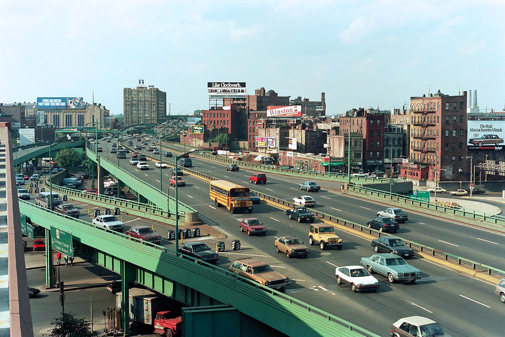
It's much easier to take a picture from
your car when traffic is at a standstill.
By this point, I'd wasted enough time that I was in danger of having to drive across three boroughs during rush hour, so I got in my car and cruised around the southern edge of Brooklyn to get into Manhattan. New York's parkways are somewhat unusual like that in that many of the roads travel close to bodies of water. This is because many of them were built on new land since there was simply no available space other than putting in some new ground. It's really quite scenic from your car but more than a bit problematic for the landscape and for people to enjoy the shore. Again, we can thank Robert Moses for his emphasis on the driving experience over all other land uses.

Traffic was heavy but moving as I drove under the Verrazano Bridge and towards the Battery Tunnel. I had several options to cross the East River, including the tunnel, the Manhattan Bridge, and a few others, but to me there was but one option:
Brooklyn Bridge all the way.
I crossed the river on the fantastically storied Brooklyn Bridge, taking time to admire its gothic stay towers and its iron stiffening trusses and its curious but effective combination of suspended and stayed cables.


If you want to hear me gushing on and on about how completely awesome all the sights I saw on my 52 mile drive through The Bronx, Queens, Brooklyn, and Manhattan, including trips under the Verrazano Bridge, over the Brooklyn Bridge, and around and around Flushing Meadows, the latest entry in my Tales from the Road is exactly what you're looking for:


Eventually, I made it to my uncle's apartment in the East Village. We caught up a bit on conversation, walked around through the local park (there are over 1700 parks in New York City!) which was very nice and tasteful in the relatively temperate weather, and finally went out to dinner at a fancy ramen noodle place. I didn't even know those existed.

The kitchen at Momofuku Noodle Bar from our seats.

In the morning, I decided I would attempt the most ridiculously thorough tour of Manhattan ever completed in under 8 hours in a style reminiscent of of the grand city tours I completed on my European adventure over the summer, so it was time to turn in for the night.

But that story will be contained in Boston Trip Part 7: How to See Manhattan When You've Only Got 8 Hours, in which I walk 22 miles through the urban jungle to see every famous site I could think of.

Tuesday, March 22, 2011

Boston Trip Part 5: The Biggest Dig

The big story from Monday was the drive I made from Elaine and Brad's in Boston to my uncle's house in Manhattan. The highlight of that leg of the trip was definitely my journey through the Big Dig in Boston. The Boston Central Artery/Tunnel Project, as it's properly known, is the largest and most expensive transportation construction project ever undertaken in the United States, costing over $14 billion - and that's before we account for interest from the construction financing (another $8bn) - for a 3.5 mile tunnel through downtown, an awesome cable-stayed bridge, a 1.6 mile tunnel under the river, and a whole lot of highway ramps.

Boston was originally served by a six-lane elevated roadway called the Central Artery, which served the purpose of adding freeway capacity without disturbing the surface roadways just fine for decades. Unfortunately, given its proximity to buildings while traveling through downtown, there simply wasn't any room to expand to handle additional traffic. Plus, it was dirty, noisy, and generally a drag on the downtown environment, so it was decided that they should just put the whole thing underground in a project that came to be known as The Big Dig.

It took 17 years and three times the original cost estimate, but they got it done. Even though they only added one lane in each direction, the added highway ramps and untangling of the east-west through route has really done a lot to tame congestion. Before the project, there would often be standstill traffic on the Central Artery all day long, whereas now delays are restricted to a more typical rush hour scenario.

And all it took was $136.6 million per lane-mile of roadway. Yes, that is quite a lot - by contrast, your average interstate through an urban area costs somewhere on the order of $2.5 million to $7 million per lane. Ouch. But hey, now instead of that green steel-and-concrete monstrosity, there's a fantastic (if narrow) park running through downtown, complete with gathering and performing arts spaces.

Anyway, the final product certainly is a sight to behold, as you can see in yet another update from the road:


After leaving Boston, the weather took a bit of a sour turn, especially in contrast with the fantastic weekend weather. Even though most still bodies of water were still covered in ice, it had been clear, sunny, and relatively warm over the last couple of days.
There were also many frozen ponds and a smattering of winter weather along the way.

But in spite of some funky weather, I still made it to the border with New York, and that's where we'll pick up in Part 6: Escape to New York, in which I visit Queens and Brooklyn on my way into Manhattan.


A lot of people have been asking about the setup I use to do the in-car videos. Well, since I don't have fancy suction cup mounts like they do on legit car shows, I have to make do with what I have. Fortunately, with a small amount of time and a bit of equipment it really doesn't take that much to position a camera at a specific location and direction in space. So I borrowed a working tripod and found a piece of wood, and with a little bit of duct tape I was in business. This probably won't reflect well on my sanity, but I even named the two camera positions:
In the front is George, named for George Frideric
HANDEL. He's on a tripod taped to the floor.
And Malcolm is in the back seat, named for
Malcom McDOWELL. You can probably guess
what he's attached to.


Boston Trip Part 4: Red Line to Braintree


My actual time in Boston went far too quickly. Between hanging around the house with Brad and Elaine, messing up our shoulders playing fake baseball on their new Wii, and going to social functions hosted by various professors and colleagues of Brad's, our time for sightseeing pretty much consisted of a few hours on Saturday. And so after spending a few hours trying to come up with a plan for the day, we finally decided to get out and not squander any more time sitting around on our computers.

Like the other trips we made during my last visit over the summer, we took the subway from the Porter station just down the street from their house in towards downtown. In addition to being part of Boston's awesome public transportation network - they have all six major types of transit: heavy rail (subways), light rail (trams), commuter rail (trains), buses, bus rapid transit (BRT), and ferries - Porter Square is noteworthy because as far as I can tell, it has one of the ten longest escalator banks in North America, and probably the second longest outside of the Washington Metro. That's nothing to sneeze at, because WMATA should have long escalators since it has 588 of them - 1.96% of all the escalators in the United States.

As you can probably tell, I've done a fair amount of reading on the subject.

Porter Square's longer escalator bank, leading down from ticketing to the inbound platform.
I'm a bit embarrassed to admit that I forgot to take a picture of this, but this image is from Wikimedia Commons.
However, perhaps my favorite part of traveling into Boston from Somerville is that you have to take the Red Line, and the trains traveling in that direction along that line are all listed as traveling in the direction of a region south of town called "Braintree." It sounds like a delightful place, mostly because this is all I can think of when I see the name:
And that's saying nothing of other endpoints along the various T lines like Alewife (apparently a type of fish) and Wonderland.

Anyway, we got off at Central Square and walked towards MIT. We ate at a small, oddly shaped grill called Miracle of Science. The coolest thing about the place was that they didn't have actual menus, instead you had to check out a big chalkboard with all their menu items and prices that was set up like the periodic table.

From there, we headed towards town through the MIT campus, eventually turning right and heading south along Massachusetts Avenue, across the Harvard Bridge (past all the Smoot markings!), and into... umm... whatever you call the area immediately southwest of downtown Boston. Is that still Boston? Anyway, compared to the crazy, snowy weather they'd been having so far this year, I was told that I should count myself lucky to have blue skies and temperatures above fifty.


We walked down Boylston Street...


Eventually reaching the Boston Public Library's main branch.


Pretty much the sole purpose of this visit had been to see their main reading room, Bates Hall. The room is fantastic, most notably for its 218' long, 42' wide, 50' high barrel vaulted ceiling and 120 identical green desk lamps. However, it felt really weird to be taking a picture of the room given just how eerily quiet it was considering just how many people were studying inside of it. Even the sound of my shutter seemed to be too much, as you can tell by the fact that I didn't retake the photo in spite of a blurry Brad.


On the way out, we saw a group of people protesting Muammar Gaddafi's rule of Libya. I fully expected him to be out of power by the time I got around to posting this entry, but it's been ten days and there's been no change.


Oh, and we on the way back we stopped at a bar to watch the VT-Duke game in the ACC Tournament, but I won't go into that experience except to say that we had some truly epic loaded fries at the restaurant.

And that mostly covers the sightseeing in Boston. On Sunday we went to a fancy brunch and then dug out some beanbags and played cornhole in their driveway and just generally hung out before it was time for me to pack up and get ready to head south on the next leg of my journey.

Next up will be Boston Trip Part 5: The Biggest Dig, in which you learn more than you ever wanted to know about America's most expensive highway project. Or, more properly, you get to watch me be a big transportation fanboy and just gawk at the bridges and the tunnels and the overpasses and the weaving sections and the signage and the lane markings all the way through Massachusetts and Connecticut.

Sunday, March 20, 2011

Boston Trip Part 3: The Journey to the Land of Potholes

I was originally going to call this post The Journey to the Land of Sports Teams of which I Am Not a Fan, but I decided that I didn't really have anything against the Giants, Nets, Bruins, or Mets, so that name would be unfair.

There had been a bit of concern over parking my car in South Philly overnight, but between the wind and the driving rain we figured that nobody was going to try to steal a car, much less the random cardboard boxes inside one. Still, I was relieved to find that it was still there in the morning for the 6-hour drive to Boston.

City Hall in Philadelphia

The first thing you notice about highway driving once you get past DC is that there are a whole lot of toll roads. Fortunately, the facilities themselves are generally well-maintained, even if the view isn't much to write home about.

"Visit scenic New Jersey!"

On the New Jersey Turnpike, things start out well enough, but as you approach New York City the exit tolls get higher and higher and the landscape turns much more barren and industrial. It's a bit like Delaware in that regard. However, you do get a pretty nice view of some of the fantastic bridges that the New York area is known for, and you pass within a few hundred yards of New Meadowlands. I was surprised to see that in addition to the stadium and a hotel, there was a large entertainment complex complete with one of those fancy indoor ski slopes. Seriously, people, this isn't Dubai - you're only 200 miles from Vermont ski country.


Before leaving the state, however, I took advantage of the uniformly low gas prices ($3.39 at all motorway service areas) and made a stop for lunch.

The Burger King at the rest stop was well stocked with the most important of condiments.
Mr. Lombardi would be proud.

After having just paid $6.95 (because that's an easy toll to collect) to exit the Turnpike, the Port Authority kindly asked me to fork over another $8 to cross the George Washington Bridge. I gladly paid it, however, because it's the only way to: 1) drive through the New Jersey Palisades, a really cool rock formation on the Hudson,


2) drive across the GW Bridge, which just looks cool


and 3) drive along the Trans-Manhattan and Cross-Bronx Expressways, which are both fantastic and terrible at the same time. (The explanation why comes after yet another report from the road...)


They're fantastic in that they're only 1.4 and 6.5 miles long, respectively, but they're some of the most heavily traveled miles of interstate in the whole country. And most of the time, they work pretty well. The really admirable thing, though, is the road maintenance. Since the roads are so busy at all hours of the day, it's next to impossible to shut down even a single lane to do pavement work. The result is tremendous strain on the asphalt, and although there are a lot of potholes it's amazing there aren't more considering the 145,000 vehicles that cross it every day. By comparison, although the Springfield Interchange near DC is even busier (430,000 cars per day), Springfield has 24 lanes at it's widest point, whereas the Cross-Bronx only has six.

Plus, if you like statistics alone, the most expensive mile of surface highway ever built was on the Cross-Bronx. It cost $40,000,000 to construct... in 1964. That's worth about $277 million today.

The downside to the project was that Robert Moses conceived of the two freeways without much if any concern for the residents of the areas in which the highway was inserted. Although he picked a very direct route through quite cheap land, the properties that were reclaimed to build the road were home to well-established communities which were subsequently ripped violently apart by a noisy, dirty traffic-drawing six-lane interstate.

In many ways, it was the Cross-Bronx that singlehandedly brought about changes to the way major highway projects are planned in this country. Through his handling of the project from conception to completion people came to see Moses as someone who was more concerned with his vision and his power than on the needs of the area. He did a lot of good things for New York in his time as an urban planner (although he was never elected, merely selected as the head of various highway/toll authorities), from developing riverside parks and helping fund construction projects through the Great Depression, but in hindsight his blind favoritism towards the automobile in an area as densely populated as New York City can be seen as a stubborn and ultimately unsustainable position.

Stay tuned for Part Four: Red Line to Braintree, in which I actually travel around in Boston.

Monday, March 14, 2011

Boston Trip Part 2: The First Step's a Doozy

On Thursday, I left for the Boston trip. Because of how things fell into place with regards to my job search, I wound up stopping over for a few hours in the DC area to interview with a transportation consulting firm. They do work with new developments and master plans for existing public complexes like universities and commercial developments. The interview went well, but getting to DC was a pain between the rain and the traffic. Congestion was quite bad - I passed a Nissan coupe that had flipped and was lying on its roof - but the people at the office were very understanding of traffic-related delays.

However, after the later parts of the interview (they had me visit two of their offices to meet more people), I still had several hundred miles to go before I could sleep for the night. Specifically, I had to make it the 47 miles to Elaine's family's house to pick up their wedding presents. As it turned out, that was the hard part. Over the course of the 27 miles I was on the Beltway, I averaged only 18 mph. It was unfortunate.

However, it gave me some time to talk more about my experiences in this, the first installment of my Tales from the Road.

Is it obvious that I've watched far too much Top Gear to want to put cameras in my car?

After dark, I continued to Philadelphia, with some detours due to high water near Elaine's house, continued slow traffic because of the rain, and a hair-raising trip across the Key Bridge in Baltimore due to the strong crosswinds (about 38 mph at the time I crossed).


"FSKM2" stands for "Francis Scott Key Bridge Marker #2", so that speed doesn't even account for the fact that the road is 190' in the air.


 It was a VERY exciting trip, but not terribly photogenic. This is a picture from flat, flat Delaware just after I was very surprised to find myself passing an enormous container ship about 400 yards to the right of my car.


Eventually, I reached the home of my cousin Vic, much later than I'd originally planned. After a brief bit of relaxation, I headed to bed in advance for the 6 hour trip across New England... coming up in Part 3: The Journey to the Land of Sports Teams for which I Do Not Care.

Thursday, March 10, 2011

Boston Trip Part 1: Mission Impossible

In the few months since I last posted a blog entry, I've taken more classes, taught more students, started and finished my thesis, and gone on a couple of pretty epic expeditions including visiting Jeremy in Wisconsin and visiting Julia in France. However, since I don't yet have a job my days pretty much consist of a whole lot of nothing.

HOWEVER, I've recently decided to go visit my friend and former roommate Brad up in Boston. The complication is that I'll be making a stop in Maryland along the way. My mission is to bring them the rest of their wedding presents from back in January, which they had to leave behind because of the flight arrangements with their honeymoon. 

Anyway, here's how Brad charged me with this assignment... or at least how it went down in my mind.